Transportation in the Arctic is a complex issue that requires balancing economic and environmental factors. The Arctic is home to significant oil and gas reserves, but extracting these resources poses a risk to the fragile Arctic ecosystem.
The region's harsh climate and remote location make transportation a significant challenge. The ice roads that crisscross the Arctic during the winter months are a crucial lifeline for communities and industries.
However, the use of ice roads also has environmental implications. The weight of heavy vehicles can damage the permafrost, leading to soil instability and erosion.
Transportation Challenges
Transportation in the Arctic comes with its fair share of challenges. Icing from sea spray and wind chill can make travel conditions hazardous.
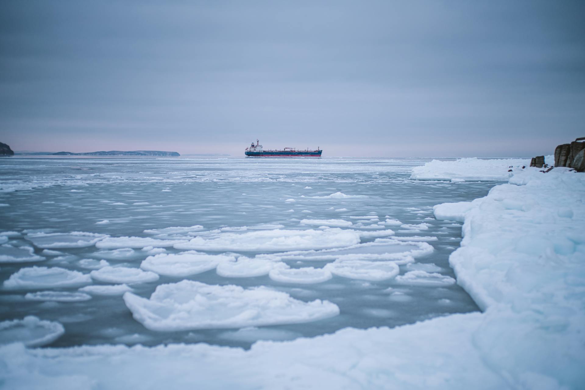
The remoteness of the Arctic region also poses significant logistical challenges for rescue and emergency operations. This can be particularly concerning during heavy ice conditions along Arctic shipping routes, which occur during the winter and spring months.
The lack of reliable weather forecasts further exacerbates these challenges, making it difficult for ships to navigate safely. The early melt season can also bring an increase in floating sea ice and icebergs, posing a significant hazard to marine transport.
Significant Obstacles Remain
Shipping through the Arctic is a complex and challenging endeavor. Significant obstacles remain, including icing from sea spray and wind chill.
Remoteness is another major issue, making rescue and emergency operations incredibly difficult. The lack of reliable weather forecasts is also a significant concern.
Ice conditions along Arctic shipping routes will remain heavy during the winter and spring months. The amount of floating sea ice and number of icebergs may increase during the early melt season.
As ice floes break apart and drift across the Arctic Ocean, the risk to marine transport increases. This poses a significant hazard to the safety of ships and their crews.
Winter Roads
Winter roads present a unique set of challenges, particularly in cold regions where permafrost and geotechnical engineering play a crucial role.
Tetra Tech, a global leader in providing ice-related services, has over 50 years of experience in the Arctic and northern regions. They engineer, design, and monitor ice structures to ensure safe on-ice operations.
In fact, they provide route planning and design for ice roads and bridges, as well as design for stationary loads and drill pads on ice. This expertise is essential for carrying out safe and efficient operations in harsh winter conditions.
Here are some of the services Tetra Tech offers for winter roads:
- Route planning and design for ice roads and bridges
- Design for stationary loads and drill pads on ice
- Ice profiling and quality assurance and quality control for ice roads and pads
- Risk assessment and operating procedures for working on ice
- Execution and remedial actions plans for operating and maintaining ice roads, including optimization
- Remediation monitoring
- Training and advanced training for working on ice
- Investigation and disaster recovery events related to working on ice
Transportation Methods
The Alaska Highway traverses Canada's Yukon Territory to link the continental United States and Alaska, its northernmost state.
There is only one railway in Alaska, the Alaska Railroad, which connects the port of Seward to the city of Fairbanks.
The Dempster Highway, a Canadian branch of the Alaska Highway, reaches Inuvik in Canada's Northwest Territories, showcasing the challenges of building infrastructure in sparsely populated areas.
Greenland has no intercity roads or railways at all, making it one of the most difficult places to travel by land in the Arctic.
Russia has the longest rail and road infrastructure in the Arctic, with railways to Murmansk and an independent railway network connecting Norilsk and Dudinka.
Draft and Beam Restrictions
The draft and beam restrictions on Arctic shipping routes are a significant concern for vessels navigating through these waters. Ships along the Northern Sea Route (NSR) must pass through narrow and shallow straits, such as the Yugorskiy Shar Strait, which is only 12-30 meters deep.
The eastern approach of the Laptev Strait has a depth of less than 10 meters, severely limiting the draft of ships to less than 6.7 meters. This restriction requires ships to be carefully designed and equipped to navigate these shallow waters.
Only a select few vessels have the required ice classification to sail the NSR, with Russia's government only permitting ships with the highest ice classification – 1A Finnish Swedish – to sail the route. Currently, only three vessels out of more than 2,000 Panamax ships have this classification.
Land Transport
Land transport in the Arctic region is a challenging task due to the vast distances and sparse population. The expense of building roads or railways is generally prohibitive in these areas.

The Alaska Railroad is a notable exception, connecting the port of Seward to Fairbanks in Alaska. This single railway is a vital link between the southern and northern parts of the state.
The Alaska Highway, which traverses Canada's Yukon Territory, provides a land link between the continental United States and Alaska. This highway was built in the mid-20th century and has since become an essential route for transportation and trade.
In contrast, Greenland has no intercity roads or railways, making land transport even more difficult. The Scandinavian north is linked to its southern metropolises by a railway that reaches the north coast of Norway at Narvik.
Russia has the longest stretch of both rail and road infrastructure in the Arctic. Its railways reach as far as Murmansk, the Ob River, and the Pur River, with a line connecting Norilsk to the Yenisey River at Dudinka.
Here is a list of notable Arctic land routes:
- Alaska Railroad (Alaska, USA)
- Alaska Highway (Canada and Alaska, USA)
- Dempster Highway (Canada)
- Murmansk Railway (Russia)
- Norilsk-Dudinka Railway (Russia)
- Magadan Highway (Russia)
Shorter Distances
Shipping through the Arctic can be a game-changer for transportation costs. By taking the Arctic route, shipping operators can save up to 40 percent on distance compared to traditional shipping lanes via the Suez Canal.
This means shorter sailing distances, which in turn means fewer days at sea and significant fuel cost savings. The reduced number of days at sea also allows ships to make more return trips, increasing revenue and potentially profits.
Super-slow sailing is another option, where vessels can reduce their speed by 40 percent and still arrive on time. This can also double a vessel's energy efficiency performance, resulting in a substantial reduction of greenhouse-gas emissions.
Arctic Infrastructure
The Arctic infrastructure is still in its early stages of development, but Russia is taking a big step forward with plans to build up to 10 emergency centers along the Northern Sea Route (NSR). These centers will focus on meteorological and rescue services as well as border patrol.

Russia plans to invest a whopping 134 rubles (€3.4 billion) into developing maritime traffic over the next 10 years, and the capacity of their seaports is scheduled to increase by 50 percent by 2015. That's a significant boost to their shipping capabilities.
The port of Murmansk and the port of Petropavlovsk are considered essential for the development of the NSR, and both are expected to serve as terminals and hubs.
Arctic Infrastructure
The Arctic region is investing heavily in its shipping infrastructure to support growing maritime traffic.
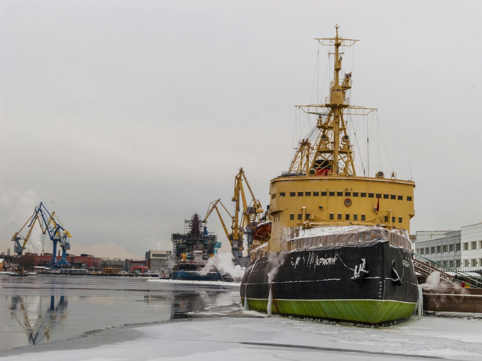
Russia has 16 ports along the Northern Sea Route (NSR), most of which are ice-covered for part of the year.
The port of Murmansk and the port of Petropavlovsk are considered essential for the development of the NSR.
Russia plans to build up to 10 emergency centers focused on meteorological and rescue services as well as border patrol along the NSR.
The capacity of Russia’s seaports is scheduled to increase by 50 percent by 2015.
Russia is investing 134 rubles (€3.4 billion) into developing maritime traffic over the next 10 years.
The port of Kirkenes in Norway and the port of Vopnafjörður in Iceland may serve as major future Arctic hubs.
The port of Vopnafjörður has a depth of up to 70m, making it suitable as a deep-water port.
Iceland’s strategic location at the entrance and exit to the Arctic Ocean makes it an attractive location for a transshipment hub.
China has been increasing its economic cooperation with Iceland, with a visit from Premier Wen Jiabao to further strengthen ties.
Navigable Arctic Ocean?
The Arctic Ocean is undergoing significant changes, making it a navigable body of water in the near future. Summer ice extent has declined by 40 percent since 1979.
Sea ice has thinned considerably, with a decline in volume of 70 percent over the same period. This drastic change has led to predictions of when summer sea ice will melt completely.
Studies suggest that Arctic sea ice may have crossed a tipping point, making ice-free summers an annual feature across most of the Arctic Ocean. This new state of low ice cover is distinct from normal seasonal sea ice variation.
Arctic sea ice has experienced a 70 percent decline in volume since 1979, making it a navigable body of water in the near future.
Economic and Environmental Factors
The harsh Arctic environment poses significant economic and environmental challenges to transportation in the region. The cost of transporting goods and people across the Arctic is extremely high due to the remote location and harsh weather conditions.
The melting of sea ice due to climate change has opened up new shipping routes, but this also increases the risk of accidents and oil spills. The Arctic is home to sensitive ecosystems and wildlife, making environmental protection a top priority.
The lack of infrastructure and limited access to resources in the Arctic makes transportation even more difficult and expensive. In contrast, the potential for new economic opportunities and resources in the Arctic is significant, but it must be balanced with environmental concerns.
Economic Feasibility
Economic feasibility is a major challenge for Arctic shipping. The unpredictability of Arctic shipping routes makes it difficult to achieve the three key factors necessary for global shipping operations: predictability, punctuality, and economy-of-scale.
More than 6,000 ships operate on regular schedules, known as liner service, which allows for stable and predictable operations. This is crucial for container ship operators who rely on scheduling journeys a long time in advance.
Trans-Arctic shipping, in particular, may face significant hurdles in becoming part of the global trade patterns. This is because trans-Arctic voyages depend on changing supply and demand of less time-sensitive items.
The lack of schedule reliability and highly variable transit times along Arctic shipping routes represent major obstacles to the development of Arctic shipping.
Longer Ice-Free Periods
The disappearance of Arctic sea ice is having a significant impact on the region's shipping routes. A NASA study found that multi-year ice, the oldest and thickest ice, is disappearing at a faster rate than younger, thinner ice.
The ice-free period along the Arctic's main shipping routes is expected to increase from around 30 days in 2010 to more than 120 days by the middle of the century. This will have a profound effect on the shipping industry.
The remaining summer ice will not be uniform across the Arctic Ocean, with sea ice collecting and persisting longest along the northern flanks of the Canadian Archipelago and Greenland. This means that the central and eastern part of the Arctic will see the most significant decline of ice.
In 2011, the navigational season along the Northern Sea Route (NSR) lasted for 141 days, from early July until mid-November. This is a significant extension of the shipping season, which will have far-reaching consequences for the region's economy and environment.
Shipping and Air Transport
The Arctic region is home to several important shipping routes, including the Northwest Passage and the Northeast Passage. The Northwest Passage, in particular, has the potential to become a valuable commercial shipping route due to its shorter distance between East Asia and Western Europe.
The distance between East Asia and Western Europe via the Northwest Passage is about 13,600 kilometres, which is significantly shorter than the 24,000 kilometres via the Panama Canal. This route is becoming more accessible due to global warming-induced climatic changes.
The Northeast Passage spans eastward along the Scandinavian Peninsula and across the Russian Arctic towards the Bering Strait. It includes the Northern Sea Route (NSR), which is likely to be ice-free earlier than the rest and is seen as the most economically promising at this point in time.
The NSR is about 40 percent shorter than the Suez Canal, with a distance of approximately 12,800 kilometres from Northern Europe to China. This route can also save 10-15 days of travel time compared to crossing the Suez Canal.
Many Arctic settlements are accessible only by air travel, often using light aircraft or helicopters. In Greenland, airfields are often impossible to build, making helicopters a common mode of transportation.
Air Transport
Air transport is a vital mode of transportation in the Arctic region. Many Arctic settlements are accessible only by air travel.
Light aircraft, often privately owned, carry much of the passenger traffic in Alaska and Canada. In Greenland, helicopters link the coastal settlements due to the difficulty of building airfields.
Long-distance flights between Europe and North America have traversed Arctic air space since the 1950s. They initially used routes pioneered by military aircraft in World War II.
Nonstop flights between western Europe and the American west coast now follow great circles farther north, sometimes passing within 600 miles of the North Pole.
Shipping
The Northwest Passage is a highly anticipated shipping route that could significantly reduce maritime shipping distances between East Asia and Western Europe. It spans through Canadian waters in the Arctic Ocean and is comprised of several routes.
The passage was first opened for use in summer in 2007 and could potentially become a valuable commercial route. The distance between East Asia and Western Europe via the Northwest Passage is about 13,600 kilometres, compared to 24,000 kilometres via the Panama Canal.
The Northeast Passage, on the other hand, spans eastward through the Norwegian Sea and the Barents Sea around the Scandinavian Peninsula. It includes the Northern Sea Route (NSR), which is seen as the most economically promising route at this point in time.
The NSR is a 12,800 kilometre route that is approximately 40 percent shorter than the Suez Canal route from Northern Europe to China. It's also 10-15 days quicker than the Suez Canal route.
The Arctic Bridge is a seasonal sea route used mostly for the shipment of grain from the Canadian Prairies to European markets. It connects the Russian port of Murmansk to the Hudson Bay port of Churchill, Manitoba, Canada, covering a distance of 6,700 kilometres.
Overview
The Arctic region has a unique transportation landscape.
Transport infrastructure is less developed in the Arctic than in more densely populated areas. This is due to the harsh climate and limited investment.
Many modes of transportation serve the Arctic, including sea, air, road, and rail. However, existing infrastructure is hard to maintain, which affects transportation volumes.
Arctic seaports, like those in Murmansk, Narvik, and Valdez, experience higher transportation volumes than ports in southern seas. These ports welcome passengers and serve as fishing ports.
Railways are a dominant mode of transportation in northwest Russia and connect Arctic seaports. However, there are few railways in the Arctic overall.
Roads are mainly found in populated areas and are primarily used to meet local needs. Air transport is highly developed in the Arctic and efficiently connects distant destinations.
Frequently Asked Questions
What is the Arctic sea transportation?
Arctic sea transportation refers to the maritime routes used by vessels to navigate through the Arctic region, connecting the Atlantic and Pacific oceans. These routes include the Northeast Passage, Northwest Passage, and the lesser-used Transpolar Sea Route.
Sources
- https://www.britannica.com/place/Arctic/Transportation
- https://www.thearcticinstitute.org/future-arctic-shipping/
- https://www.tetratech.com/solutions/transportation/arctic-transportation/
- https://transportgeography.org/contents/chapter1/transportation-and-space/polar-shipping-routes/
- https://arctic.review/economy/shipping-and-transportation/
Featured Images: pexels.com